A Grey-Day Shore Walk, Planned Around Texture
Plan a grey-day shore walk around sand, stone, water, and weathered wood, with practical prompts for noticing coastal detail while keeping your route flexible.
Your boots leave dark prints in damp sand as a low sky blurs the horizon. A grey-day shore walk can feel quietly absorbing when you follow the beach’s small arrangements: a band of pebbles, a driftwood snag, or a path worn through the dunes.
Plan a short visit around a route you can leave easily and a few details worth recording. Rather than chasing a dramatic view, pay attention to how people, natural materials, and shoreline features share the space.
What details make a grey-day shore walk rewarding?
Look beyond the waterline. A beach has working edges and human traces: access steps worn smooth, a harbor marker set against the shore, or a strand of seaweed caught beside a groyne.
Choose a few subjects that suit the place, rather than turning the walk into a scavenger hunt:
- Access points: Notice whether a ramp, stairway, or path directs visitors toward one part of the shore. If it is marked and open, follow it; if it is closed or unclear, choose another permitted route.
- Shoreline boundaries: Look for a line of wrack or a change in ground that marks where material has gathered. If the boundary is easy to see from the path, note its shape; if reaching it means crossing a barrier or soft ground, observe from where you are.
- Public fixtures: Check how benches, signs, or harbor fittings sit within the landscape. If they are accessible from a public route, record their placement; if they are behind a barrier, keep your distance.
- Footpaths and tracks: Observe where visitors tend to walk and whether a marked path keeps them away from fragile ground. If a clear route is available, stay on it; if the route is muddy or closed, turn back rather than creating a new track.
- Weathered wood: Look at a public bench, boardwalk, or timber fixture for visible grain and softened edges. If the structure appears sound and is open to visitors, view it from the path; if it is broken or unstable, avoid it and report the concern to the local site manager.
- Signs of local use: Notice a boat landing, fishing area, or public access notice without disturbing anyone’s activity. If the space is open and unoccupied, pause without blocking it; if people are working or the area is restricted, move on.
Keep observations visual. Do not handle sharp debris, climb on structures, or disturb plants and wildlife to get a closer look.
How can you choose an easy route?
Pick a public beach, harbor edge, or signed coastal path with a clear way back. A short out-and-back works well because you can turn around without needing to reach a distant landmark.
Before leaving, check local tide information, the weather forecast, access notices, and posted restrictions. Follow official site guidance, and ask a ranger or local authority if access is unclear. Avoid a route that depends on crossing a rising tide, unstable cliffs, or waterlogged ground.
Choose a modest endpoint, such as a signed access point or a public bench. Turn back there, or earlier if conditions change. Keep your phone charged, and let someone know your general plan if you are visiting a remote stretch alone.
How should you record what you notice?
Use a notebook, a notes app, or a voice memo. A concise record works well: name the feature, describe its position, and note what surrounds it. “Public steps end beside a broad strip of pebbles” is more useful later than “interesting beach.”
If you take a phone photo, include a nearby feature for context, such as a sign beside an access path or driftwood caught near a public fixture. Stay on the marked route and do not approach the water or cross a boundary for a better angle.
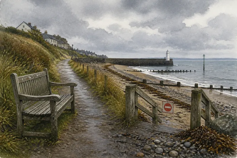
Say you arrive at a public harbor path and find the signed route open, a bench beside the path, and a closed stairway down to the beach. You note the bench’s position in your phone and photograph the closed stairway from the path; the result is a useful record of both an accessible stopping point and a route you should not use.
What should you check before heading out?
Is a cloudy day good for a shoreline walk?
It can be, but cloud cover does not make every route comfortable or safe. Check the forecast and local conditions before you go, then shorten the walk if visibility, wind, or rain becomes a concern.
What should you bring for a short walk?
Wear footwear suited to the path, bring an outer layer for the forecast, and carry a charged phone or notebook if you want to make notes. If conditions call for more than you can comfortably carry, choose a shorter route or postpone the visit.
Can you take driftwood or stones home?
Rules differ by location, and natural material may be protected or part of local habitat. If posted guidance explicitly allows collecting, follow it; otherwise, leave the material in place and check with the site manager if you are unsure.
What should you do if access is unclear?
Do not guess at a closed or ambiguous route. Check posted notices or ask a ranger or local authority; if you cannot confirm access, stay on a clearly marked public path and turn back when it ends.
How can you keep the visit low-impact?
Use marked access routes, take your litter away, and leave natural materials where they are. Give wildlife room, follow barriers, and avoid blocking paths or working areas. Looking closely does not require touching.
Before you leave, note one feature that explains how the place is used: perhaps a public path ending at a harbor, or a bench set back from a closed access stairway. That single observation can make your grey-day shore walk more specific, while keeping your attention on the landscape and the people who share it.
Save the note with the beach or path name if you know it, and include any access change you encountered. On a later visit, check current signs rather than assuming the route is still open; coastal access can vary with local conditions and site rules.